Housing & Growth Management

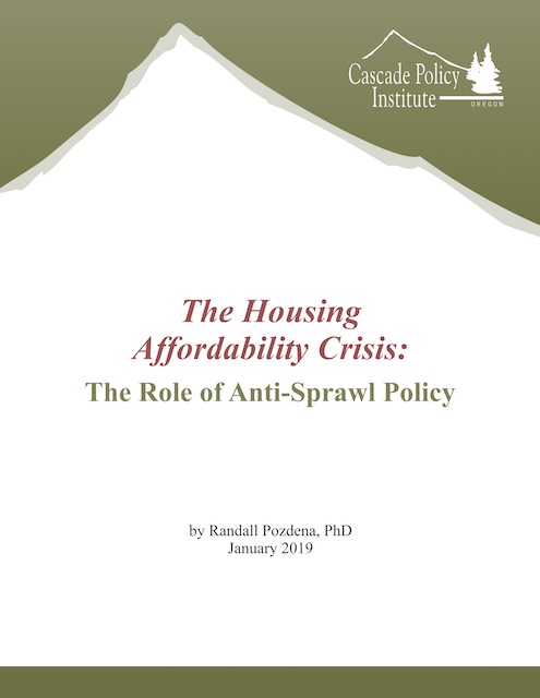
A new report by Oregon economist Randall Pozdena demonstrates “that those states that fail the affordability and supply adequacy test are overwhelmingly those with documented adoption of one or more aggressive anti-sprawl growth regulatory initiatives.” In other words, growth management, not single-family zoning (which is found in all 50 states) makes housing unaffordable.

Click image to download a copy of this study.

Pozdena shows that housing is in short supply — that is, new home construction is not keeping up with population growth — in just 23 states. Housing is getting expensive and unaffordable in those states but not in the other 27. Continue reading

What If We Free San Francisco?

Someone recently alerted me to a 2017 article in Forbes in which my friend Scott Beyer, who considers himself a market urbanist, asks, “How would San Francisco develop under an open market?” His incorrect answer is that it would be even denser than today.

He bases that on the fact that in parts of the Bay Area where housing prices are highest, population growth is low. The latter, he says, is due to NIMBYism preventing construction of new housing. Get rid of NIMBYism (by getting rid of zoning), and new housing would spring up denser than ever before.

Beyers is correct that NIMBYism is a real problem. But it is not the main reason why Bay Area housing is expensive. As Bay Area developer Nicolas Arenson pointed out in a presentation to the Metropolitan Transportation Commission in May, 2015, high-density housing costs more to build per square foot than low-density housing — up to 650 percent more depending on the density. Land also costs more in areas that are already developed. As if that’s not enough, Arenson adds that dense housing “sells at a discount” to single-family homes. Continue reading

Don’t Be Like [Insert City Name Here]

Emily Badger, who is fast becoming the Antiplanner’s favorite writer at the New York Times, has an article this week about how cities are trying not to be like certain other cities. Seattle doesn’t want to be like San Francisco; San Francisco doesn’t want to be like Manhattan. Kansas City doesn’t want to be like Denver.

“You don’t want to become Manhattan (too dense), Portland (too twee), Boston (too expensive), Seattle (too tech-y), Houston (too sprawling), Los Angeles (too congested), Las Vegas (too speculative), Chicago (too indebted),” says Badger. Too bad she had to spoil it by including Houston, which (as she pointed out in a previous article) many people think is the model other big cities should follow.

Part of the problem is that people just don’t like big cities. The same Gallup poll that found that more Americans of all age groups would rather live in rural areas than big cities also found that more Americans of all age classes would rather live in a suburb of a big city than in a big city itself, and that more Americans of all age classes except 18-29 year olds would rather live in a small town than a big city (and among 18-29 year olds the difference was only 1 percent). People dislike big cities because they tend to be more congested, impersonal, and crime-ridden than small cities or suburbs. Continue reading

How Much Density Is Enough?

Portland New Urbanist Joe Cortright has rarely seen a high-density development he didn’t like. Like Marxist economists who always begin their papers by referring to quotations from Karl Marx, Cortright takes his cues from Jane Jacobs.

Most recently, he argues that the reason why most Millennials, along with most people of almost all other categories, live in suburbs is that they are forced to do so by evil zoning rules that prohibit that densities that people actually prefer. Or, as he put it, there is a “pent-up demand for more urban neighborhoods that can’t be satisfied because of zoning.”

He bases his claim on a survey of people in Atlanta and Boston asking whether they would prefer to live in a walkable neighborhood or an auto-oriented neighborhood. More people in Atlanta preferred auto-oriented neighborhoods, and 90 to 95 percent of the auto-oriented people in both cities actually lived in auto-oriented neighborhoods. However, in Atlanta, just 48 percent of people who said they preferred walkable neighborhoods were able to live in such neighborhoods, compared with 83 percent in Boston. Cortright attributes the shortfall in walkable neighborhoods to zoning. Continue reading

Driverless Cars Threaten Guru’s Vision

Urban planning guru says driverless cars won’t fix congestion,” says the New York Times. Naturally, the Times is referring to Peter Calthorpe, one of the few people who might be considered an urban planning guru and the one who has the most to lose if driverless cars are successful.

In the 1980s, Calthorpe developed a vision of what cities should be like. That vision combined the five-story apartments in Greenwich Village, which was built in the 1890s and praised in Jane Jacobs’ 1961 book, the Death and Life of Great American Cities, with the idea of jobs and dense housing being located in regional and town centers scattered around the urban area, which was the way cities were built in the 1920s. Each of the centers, Calthorpe thought, would be walkable like Greenwich Village and the centers would be connected with one another by mass transit such as light rail.

In other words, Calthorpe’s vision was already 60 to 90 years out of date when he thought it up. It is even more out of date today. In most urban areas, only about 30 percent of jobs are located in various centers, with the other 70 percent scattered finely across the landscape and virtually inaccessible to mass transit. Continue reading

Property Tax Time

Oregon property owners received their tax bills last week, which gives the Antiplanner the opportunity to rant about economic development. I divide my time between Bandon, which is in Coos County, and Camp Sherman, which is in Jefferson County but actually is tributary to Deschutes County. As I’ve noted before, Coos and Deschutes counties have very similar histories up until 1980, and then followed very different paths.

Before 1980, both counties were heavily dependent on resource extraction, chiefly timber but also minerals, agriculture, and in Coos County commercial fish. As of 1980, Coos County’s population of 64,000 was slightly ahead of Deschutes’ 62,000, and both had similar per capita incomes.

After 1980, the timber industry crashed, mining disappeared, agriculture declined in importance, and commercial fishing also declined. Deschutes County responded by becoming a recreation mecca, drawing in retirees and new businesses that wanted to locate in one of the West’s hot spots. Coos County, however, disdained recreation jobs and instead has attempted to bolster its resource industries with one get-rich-quick scheme after another. Continue reading

California Feudalism

Feudalism was about the concentration of wealth and power in a relative handful of people,” say New Geographer Joel Kotkin and big-data whiz Marshall Toplansky. By that definition, California is increasingly feudalistic, they argue in a new paper, California Feudalism.

“At its essence, feudalism was about hierarchy, and the domination of land ownership by a relative few,” says the paper. In contrast, “a strong, land-owning middle class” has played a central role in more egalitarian societies, ranging from ancient Greece to the United States of the 1960s. California’s land-use and energy policies run counter to such a land-owning middle class, which helps explain why California’s homeownership rate peaked in 1960 and today is one of the lowest in the country.

Kotkin and Toplansky are not the first to compare restrictive land-use policies with feudalism. The Antiplanner’s 2016 paper, The New Feudalism, noted that under the old feudalism the government or a small number of people owned nearly all of the land, while under the new feudalism, more people own land but the government strictly controls what they can do with it. More than 30 years before that, private property advocate and vice-president of the Ethan Allen Institute John McClaughry applied the same term to the same type of regulation in an environmental law review article. Continue reading

Freedom in the Fifty States

The Cato Institute released its assessment of freedom in each of the fifty states last week, and it generally does a good job of distinguishing between states that heavily restrict people’s lives and ones that allow more freedom. But the Antiplanner has been concerned that the many different indices of freedom published by various groups don’t seriously consider property rights, which most libertarians believe are the fundamental basis of freedom.

This year’s report attributes about 11 percent of the score for each state to property rights. Most of that 11 percent comes from two factors: rent control (5.3 percent) and zoning (4.8 percent). Rent control is easy to identify but it is not a very good indicator of freedom because most states don’t allow it or allow it only under special circumstances. Only four states allow it outright, and not surprisingly given the weighting these make up four of the five lowest-scoring states on property rights.

Zoning is much more difficult. The fifty-states report relies on the Wharton Business School’s index of zoning, but that is more than a decade old and fails to accurately assess just how flexible zoning is in some states and inflexible in others. Even more than Wharton’s index, the report relies on an index of court decisions on land-use issues, which seems more reliable as a guide to how litigious people are than to how restrictive their land-use rules are. Continue reading

Let’s Be as Dense as Hong Kong

Vox‘s Johnny Harris looks at housing in Hong Kong, noting that it is rated the least-affordable housing market in the world. (At least the English-speaking world, China, Japan, and Singapore, which are the housing markets reviewed in Wendell Cox’s 14th International Housing Affordability Survey). Harris shows living conditions roughly similar to the 1890 tenements of New York City documented by Jacob Riis in How the Other Half Lives.

Harris reveals that housing prices aren’t high because Hong Kong has run out of land. Instead, he notes, “Flying over Hong Kong, you start to see that, while yes, there’s a very dense urban landscape, but there’s also a whole lot of green space. Government land-use data says that 75 percent of the land in Hong Kong is not developed.” Continue reading

Visualizing Land Use

The National Resources Inventory samples the nation’s lands to estimate how much is dedicated to farms, forests, cities, and other uses. Formerly called the natural resources inventory, it is conducted about every fives years by the Department of Agriculture’s Natural Resources Conservation Service, which itself was formerly called the Soils Conservation Service.

The Antiplanner previously reported on the results of the 2012 inventory, including a special spreadsheet showing urbanized lands that wasn’t included in the published documents. Now, for those people who prefer looking at maps over looking at spreadsheets, Bloomberg has published a series of maps attempting to show the relative amounts of forests, pasturelands, croplands, urban areas, and other land uses in the contiguous 48 states.

For the most part, the maps and explanations are fair and balanced. But there are some elements that can be misleading. First, the second map paints the nation with six vertical stripes, each representing a major land use: pasture/range, forest, cropland, special use, miscellaneous, and urban. Because urban is the eastern-most stripe, it ends up covering eight states — Connecticut, Delaware, Maine, Massachusetts, New Hampshire, New Jersey, Rhode Island, and Vermont — as well as parts of New York and Pennsylvania. Continue reading