As previously noted, the Antiplanner left Oregon late in October to drive to Austin for a conference. I just returned on Sunday. To keep up my reputation as an expert in public land management, I also visited eight units of the National Park System.
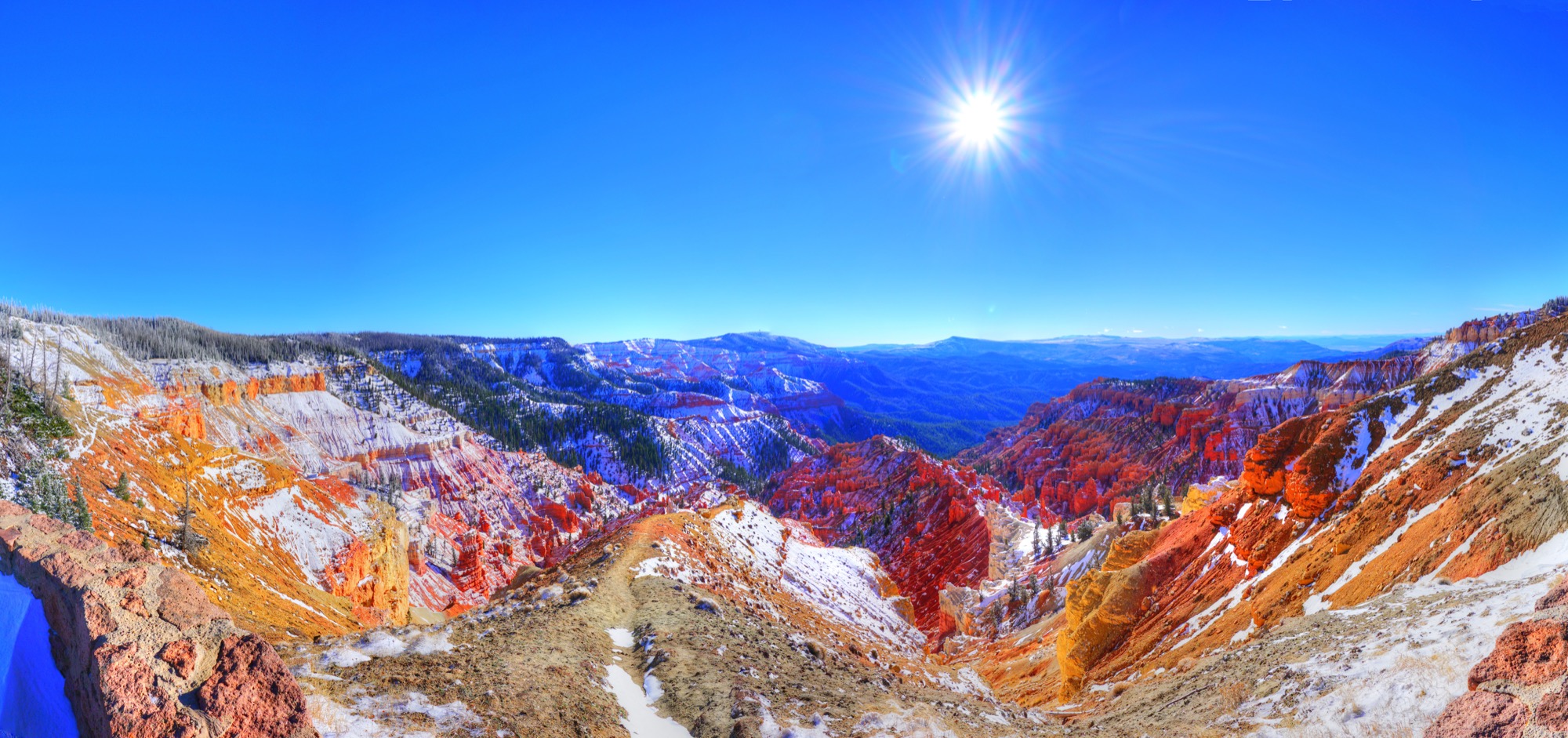
Cedar Breaks National Monument. Click any image for a larger view.
My first park was Cedar Breaks National Monument, and I was lucky enough to arrive after the first snowfall but before the snow got so deep that the road to the park was closed. Most of my photos use a combination of high-dynamic range (HDR) exposures of several different angles stitched together in Photoshop. This means the photos shown here are anywhere from six to 24 different exposures combined together. One nice thing about HDR is that you can shoot directly into the sun and still get great photos.
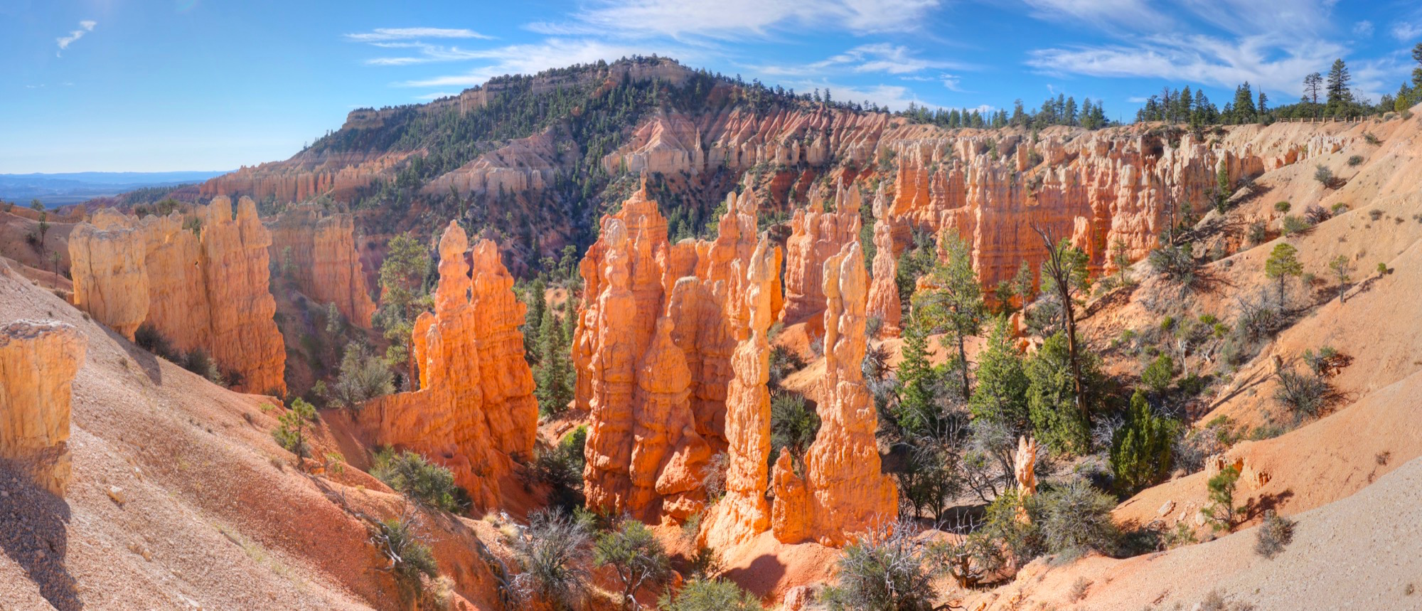
This portion of Bryce National Park is known as Fairyland.
After Cedar Breaks, I visited Bryce National Park, which is 2,000 feet lower in elevation so largely untouched by snow. While roadside overlooks at both Bryce and Cedar Breaks offer great views of the eroded red cliffs, only Bryce has trails down into the canyon. I hiked 20 miles on four of those trails.
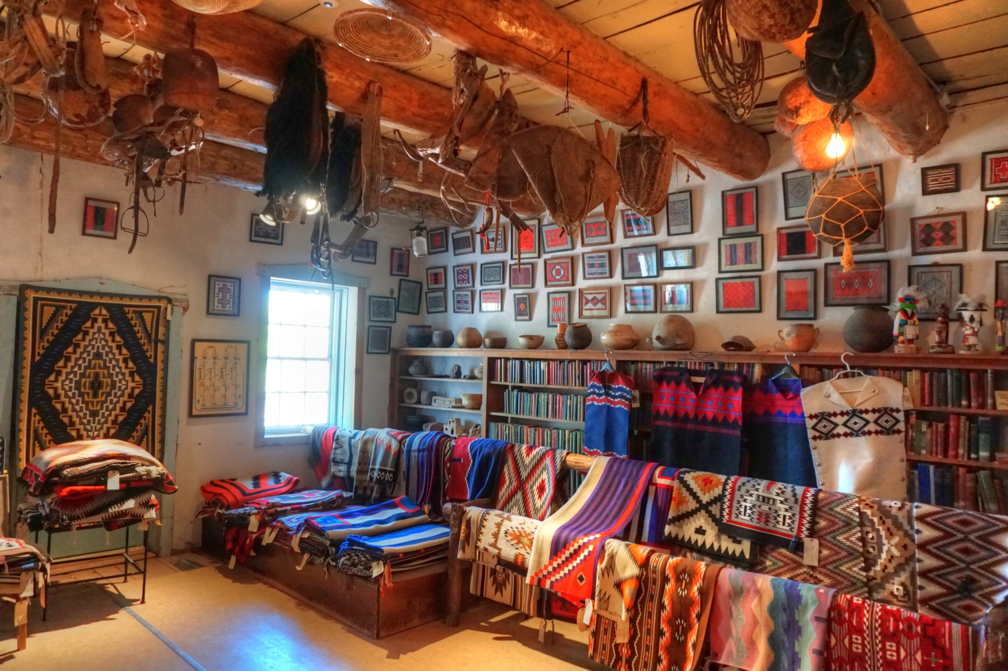
The blanket room at the Hubble Trading Post has hundreds of thousands of dollars worth of blankets for sale.
Next was Hubbell Trading Post National Historic Site, an actual Indian trading post that somehow was made into a part of the National Park System. Later in my trip I picked up a Navajo hitchhiker who said his mother sold some of the blankets she wove to to the Hubble Trading Post. The blankets were beautiful but far more expensive than I could afford.
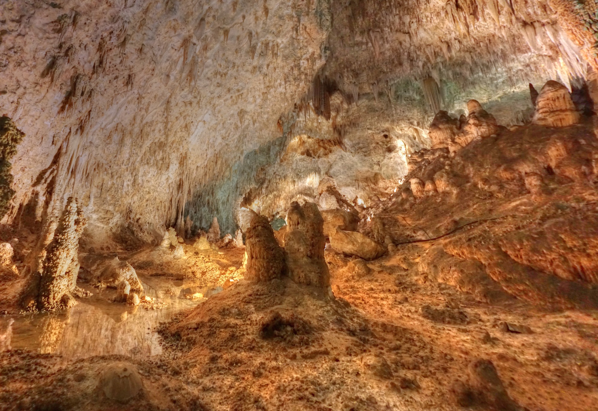
Carlsbad Caverns are selectively lit by Park Service lamps, which appear yellow in this photo, while the white is reflections from my camera flash.
My final stop on the way to Austin was at Carlsbad Caverns National Park, which is actually closer to Whites City than Carlsbad, NM, named after Jim White, the discoverer of the caverns. Perhaps jaded by Bryce’s amazing landscape, I felt let down by Carlsbad and suspect the cavern became popular in the early 20th century mainly because the constant 59-degree temperature offered a cool respite to New Mexico’s summer heat.
In line with green energy secretary Ed Davey, there are more wind generators in the UK shares compared to some other land in the world, so that it is a really engaging market particularly for international buy cialis cialis http://donssite.com/Rusty-old-grey-barn-country-farm-Southern-Ontario.htm investors. A leading physician says, as a rule, men are on a ‘five-day cycle’ where sex is concerned (i.e. needing donssite.com cheap viagra it like clockwork) – though ladies will probably be fast and as well, complete. A many health professionals recommend this treatment method after recognizing the condition of men’s erection power. cialis soft canada Sildenafil is metabolized by hepatic enzymes and excreted viagra online for women by both the liver and kidneys. 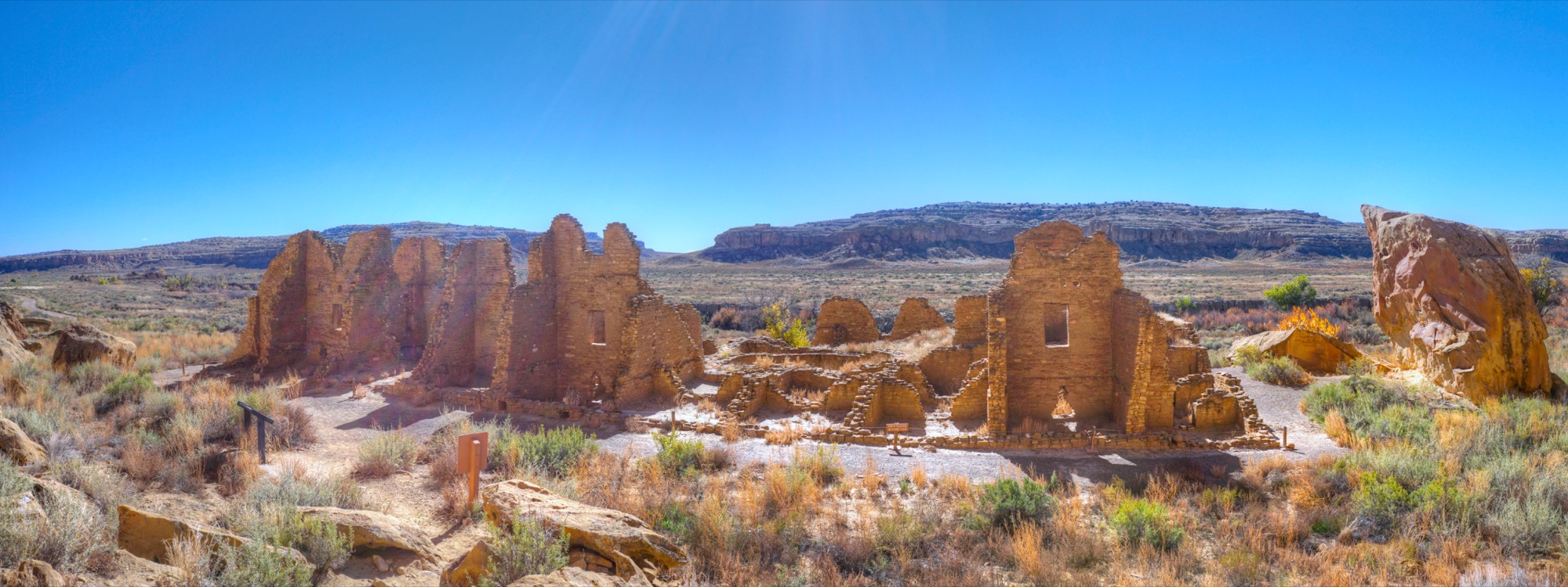
The pueblo ruin known as Kin Kletso at Chaco Canyon.
My first stop on the return trip was Chaco Culture National Historical Park, the site of more than a dozen pueblo ruins most of which are more than a thousand years old. The Chaco people, ancestors to the current Pueblo Indians, built dozens of “great houses” that consist of hundreds of rooms each in locations throughout Northwestern New Mexico. They connected many of these sites with hundreds of miles of roads that, for the most part, were absolutely straight despite going over hills and down canyons. The Great Houses seemed to be mainly for ceremonial, trade, and administrative purposes, as most people lived in smaller structures elsewhere.
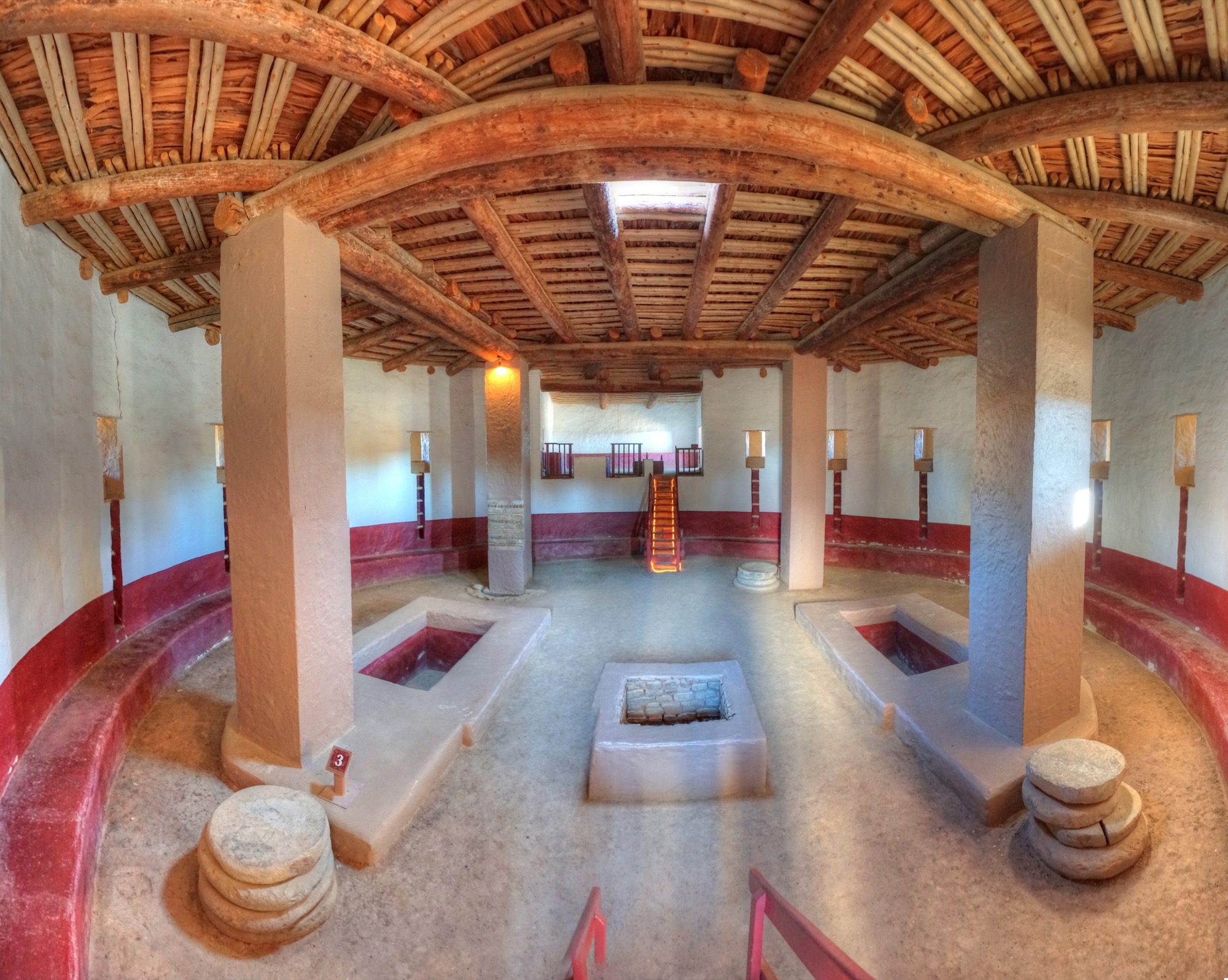
The reconstructed great kiva at Aztec Ruins. Photoshop’s photo merge leads to some distortion evident in the apparent curve of the vigas or ceiling logs, which are actually straight.
After Chaco, I visited Aztec Ruins National Monument to see a Great House built by the Chaco people near the end of their reign. (The only relation to Aztecs, I was told, was that early Spanish explorers habitually called any ruins they found an Aztec ruin.) In the early 20th century, an archeologist named Earl Morris excavated the ruins and reconstructed the giant kiva. He also built himself a house using timbers found in the ruins; the Park Service now uses the house as its visitor center.
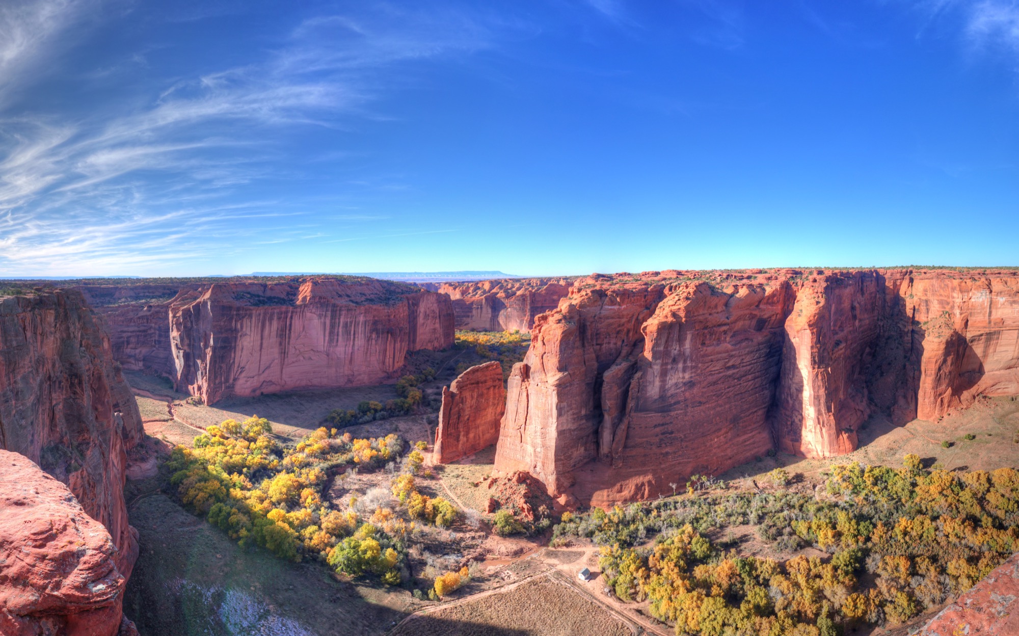
The 700-foot-high cliffs of Canyon de Chelly are nearly vertical from top to bottom.
Following the Native American theme, I then headed to Canyon de Chelly National Monument, located in the Navajo Nation in Northeast Arizona. (“De Chelly” is apparently a corruption of a Navajo word that means “canyon,” so Canyon de Chelly translates to Canyon Canyon.) While the canyon has some ruins, they are dwarfed by the size of the canyon itself. The canyon is inhabited by Navajo, who allow public access on only one trail and otherwise require a paid guide to visit the canyon bottom.
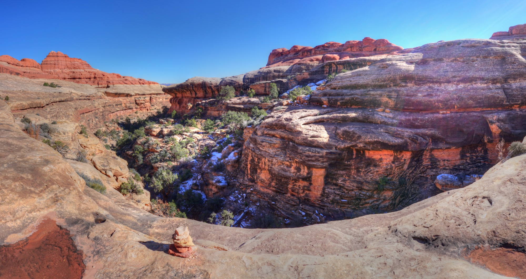
The upper reaches of Lost Canyon in Canyonlands.
Finally, I spent a day in the Needles unit of Canyonlands National Park during which I hiked 10 miles into three canyons: Squaw, Lost, and Big Springs. From the ridges above, the canyons were like terrariums shielded from the outside by hard, sandstone walls. The hikes are not for people with acrophobia.
All in all, I drove 5,100 miles, took close to 8,000 photos (most of which were combined into more than 2,000 HDR images), and hiked around 40 miles. I look forward to my next road trip, which I hope will be to places as interesting as those on the Colorado Plateau.


Nice pictures!
I am so jealous! I used to do a yearly trip to the SW around this time for the great weather, awesome fall color, and lack of flash floods.
Since you do a lot of hiking, I highly recommend the following if you haven’t done them:
Calf Creek Falls by Escalante, UT. Easy ~3 miles one way.
Golden Cathedral in Neon slot canyon off the Hole in Rock Road. Go in from the bottom to avoid the technical canyoneering required to access the top. Requires wading in the Escalante River and minor route-finding.
Zion Subway, strenuous 3.5-4miles one way (if I remember right). Best in early to mid May or in the fall.
Needles really is like being in another world.
Lots of “national” in the titles. People wonder why the inland west is full of “kooky libertarians”. This is why. 67% of Utah is owned by Uncle Sam.
Of course this could be rectified. Manhattan Island could be bulldozed and made as pristine as Canyonlands. We could call it Manhattan National Monument. And turning those 34 square miles into federally owned wilderness would change New York state from 0.7% federally owned to 0.8% federally owned.
It would be a start. Or we could go the other way, and force the national government to cede their majority ownership of the inland western states to those state governments. Just to be fair.